
Estonian World compiled a list of 15 unique sites in Estonia, Latvia and Lithuania worth a visit.*
We asked our colleagues in Latvia and Lithuania to point out some of the most unique, the most interesting sites in their respective countries and added some of our own.
These are the sites you can and should visit as they might help you get out of your own bubble of self-containment and provide you with some unique experiences in the three countries. It is, of course, not an ultimate list, and we are not saying these are the absolute must-go sites in Estonia, Latvia and Lithuania; this is a selection of sites that in our view are worth one – but there are many more.
Estonia
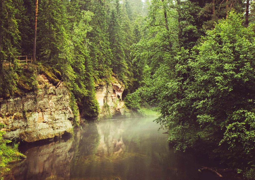
Taevaskoda outcrops
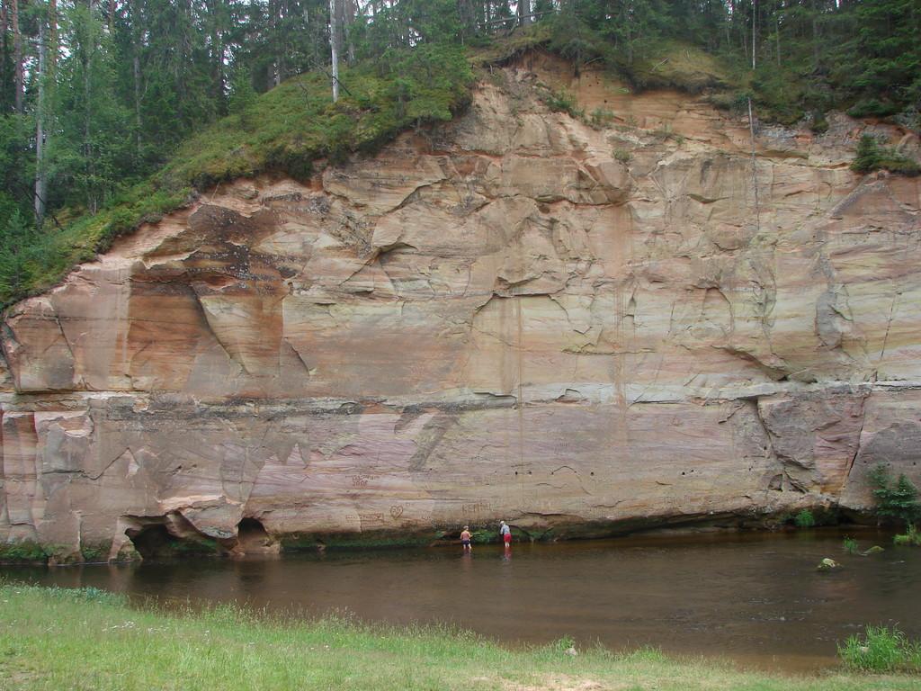
The Big and Small Taevaskoda, on the banks of the valley of Ahja River in south-eastern Estonia, are among the most scenic sites in the country and have always been cherished by Estonians. It has been even said that this is a place that every Estonian visits at least once in their life.
The ancient Devonian sandstone outcrops, of which the Big Taevaskoda rises 22.5 metres (74 feet) above the serene and peaceful river, small caves and fresh springs form a mesmerising scenery.
The place is also associated with many local legends, one of which speaks about a mermaid with a golden comb. Locals have also always believed the water from the largest spring in the valley, Emaläte (“The Mother Source”), to be miraculously healing – so don’t be surprised if you see people washing their faces or filling up water bottles by the spring.
Fun fact: an Estonian cult film, “Viimne Reliikvia” (“The Last Relic”, 1969) was partly filmed here.
Piusa caves
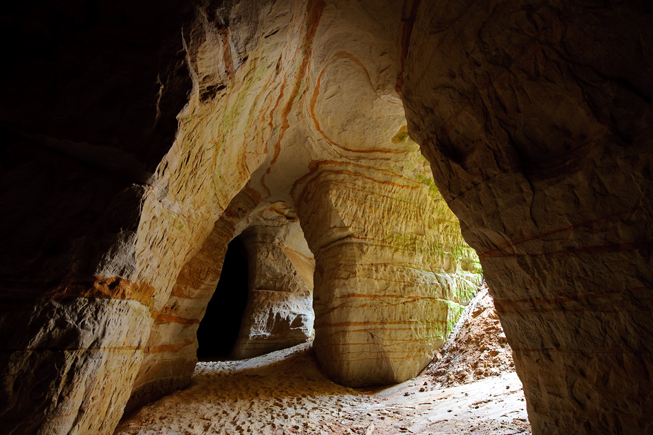
The Piusa caves are manmade caves in Võru County, Võru Borough, near the Piusa railway station. These caves were dug from 1922-1966 when they were used for mining glass sand – a type of sand used for making glass. During the period of mining, the miners dug around 20 kilometres (12 miles) of shafts.
The caves are the Baltics’ largest wintering areas for bats – seven different species of them. During the wintering months, the number of bats hibernating in the caves can be up to 3,000. You can visit the caves by the way of a visitor centre with an accompanying guide.
Kõpu lighthouse
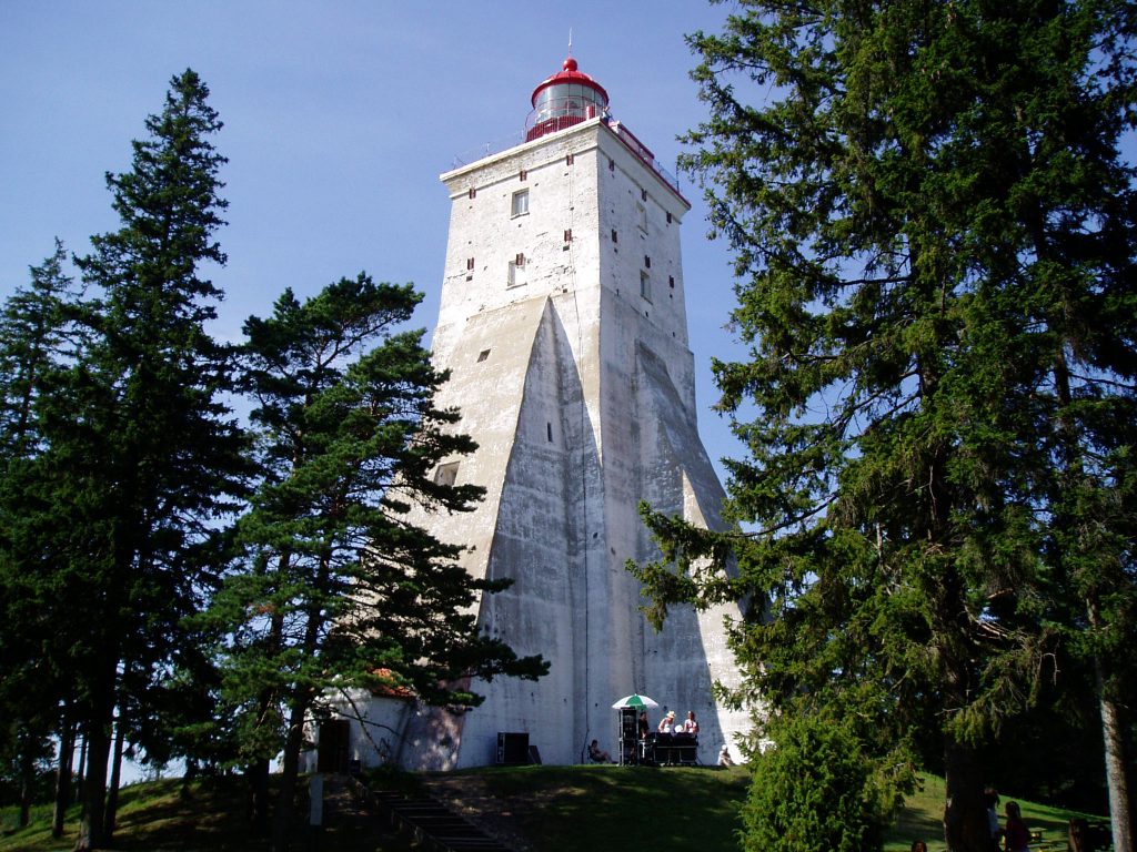
Kõpu lighthouse is one of the best-known symbols and tourist sights on the Estonian island of Hiiumaa. It is one of the oldest lighthouses in the world, having been in continuous use since its completion in 1531.
The lighthouse marks the Hiiu Shoal and warns ships away from the shoreline. The light from the lighthouse can be used for navigation as far as 26 nautical miles (48 kilometres, 30 miles) away.
The lighthouse is built at the top of the highest hillock of Hiiumaa island, Tornimägi, that itself is 68 metres (223 feet) tall. The height of the building itself is 36 metres (118 feet) and the light is 102.6 metres (337 feet) above sea level, making it the highest coastal light on the Baltic Sea.
It is located a 32-minute car journey away from Kärdla, the regional capital, and every local knows where it is. But just in case, its coordinates are 58° 54′ 57.48″ N, 22° 11′ 58.86″ E.
Kaali crater
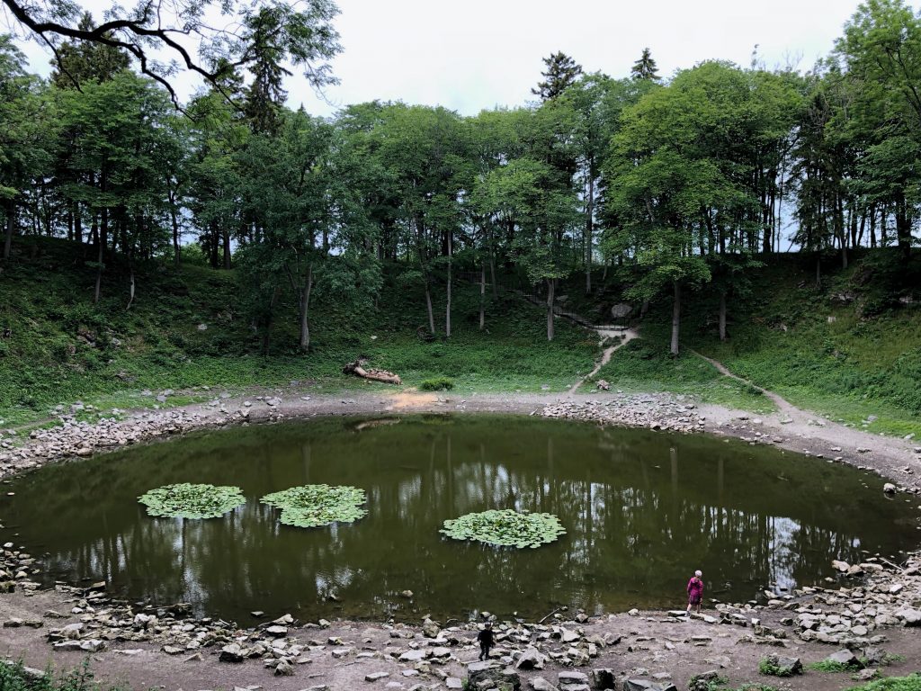
The Kaali crater in Saaremaa island, just about a 16-minute drive north-east from Kuressaare, is a meteorite crater that formed around 1530-1450 BC – created by a meteorite impact and is now one of the few impact events that has occurred in a populated area.
The main crater has the diameter of 110 metres (361 feet) and the depth of 22 metres (72 feet), and it is surrounded by a 4-9-metre (13-30-foot) ridge. The crater is, reputedly, the youngest big meteorite crater in Europe.
Old Believers’ villages near Lake Peipus
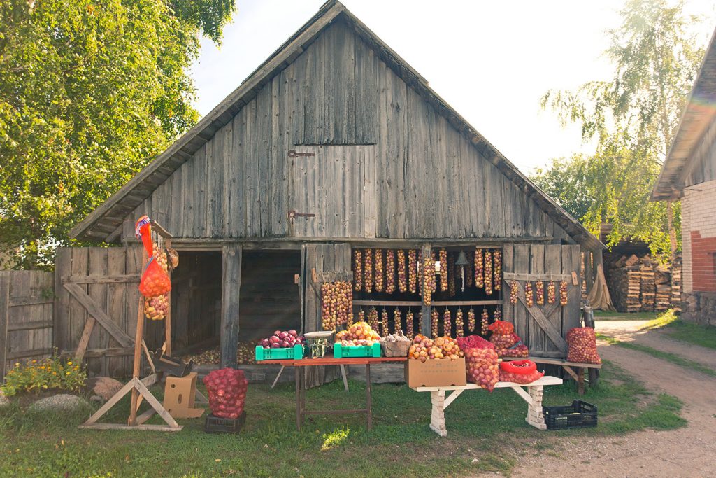
The Old Believers are sect of the Eastern Orthodox Church who, after the reform in the Russian Orthodox Church in the mid-1600s, decided to defy these reforms and were denounced by the church as a result. Many of them fled the persecution and sought refuge in the then-Swedish controlled Estonia. They settled around Lake Peipus in Eastern Estonia, the largest Estonian lake that lay directly between Estonia and Russia.
Many of these unique villages remain to this day. They are located by a single main road, called the “onion route” that runs along Lake Peipus and form miles of settlements.
To learn about the Old Believers’ history, visit the Kolkja musem and definitely have a meal at one of the local restaurants. And, you can by local fish and onions from the villagers.
Latvia
Cinevilla Studio
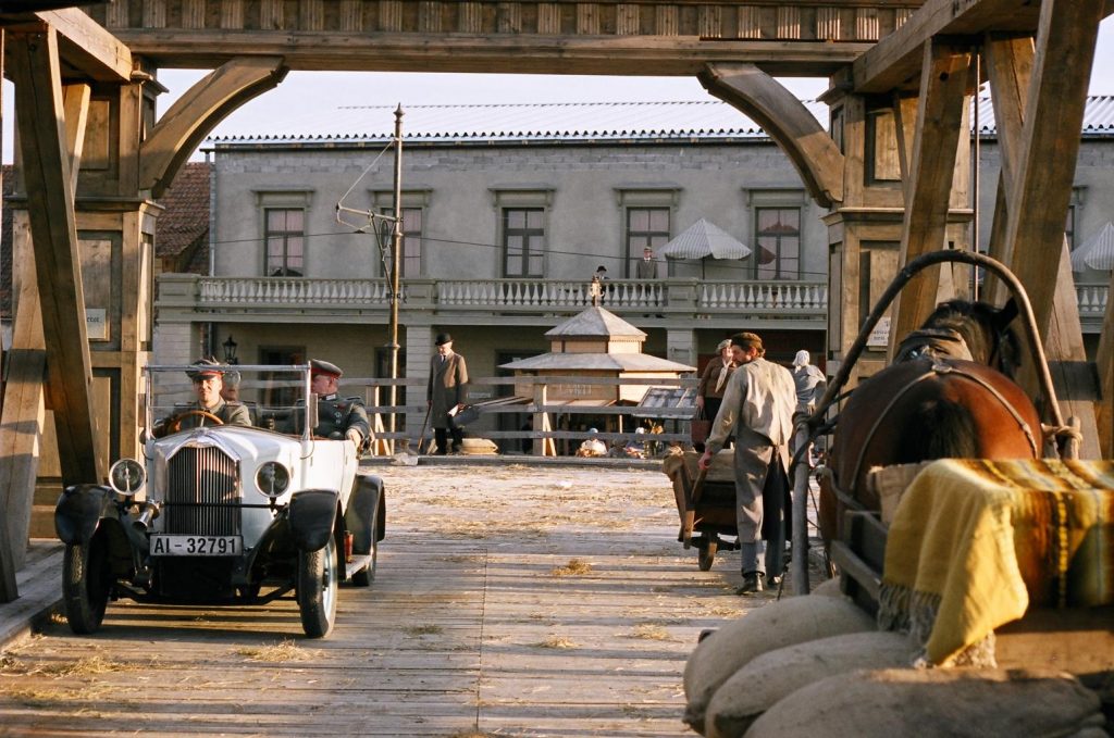
The Cinevilla backlot is located 15 kilometres (nine miles) from the town of Tukums (that itself is about 30 kilometres (19 miles) from the picturesque resort town of Jurmala), in Slampe Parish.
The backlot was built in 2004 for the shooting of the “Defenders of Riga” – a movie about the freedom battles in 1919, when both the Germans and Russians were trying to annihilate the newly-independent Latvia, established in 1918. Since then, several other Latvian and foreign films have been shot at the backlot, but the place is also open for visitors.
According to Latvian tourism experts, “a visit to Cinevilla is like travelling in a time machine – you will see what Riga looked like about a hundred years ago”. When movies are not being shot, small number of visitors can also spend the night in Cinevilla.
Daugavpils fortress
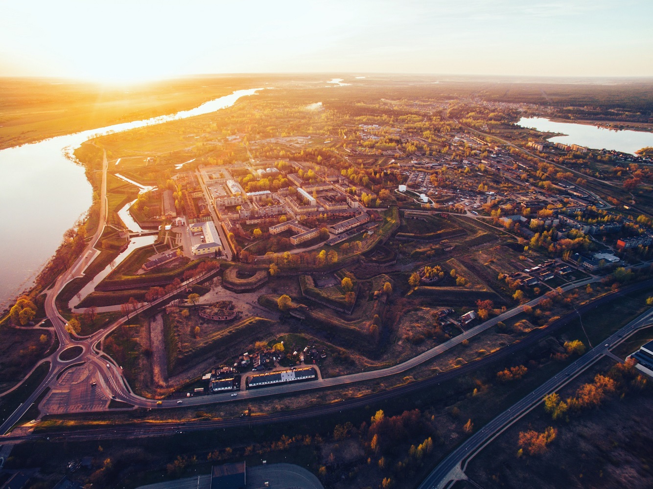
The Daugavpils Fortress, built by Imperial Russia, is an early 19th century fortress in the town of Daugavpils. It is claimed to be the only early 19th century military fortification of its kind in Northern Europe that has been preserved without significant alterations. The construction began in 1810 but was not fully completed until 1878.
In 1812, the fortress was attacked by a detachment of the French Army of 24,000 men, during the Napoleon Bonaparte-led French invasion of Russia (Latvia was part of the Russian Empire at the time). The fortress was defended by 3,300 men with 200 cannons and the attack was successfully repelled.
The fortress has 10 streets and 80 buildings. Today, a former arsenal building houses Mark Rothko Art Centre, dedicated to the namesake Jewish painter who was born in Daugavpils.
The Venta Rapid
At 249 metres (817 feet), the Venta Rapid is the widest waterfall in Europe and it becomes as wide as 270 metres (886 feet) during the spring floods. Situated on the Venta river in Kuldīga, the height of the falls varies from 1.80 to 2.20 metres (5.9 to 7.2 feet), depending on the level of water in the river.
Running parallel, just 240 metres (787 feet) from the waterfall, is the Kuldīga brick bridge. Built in 1874, it is the longest operating brick bridge in Europe.
Riga Ghetto Museum
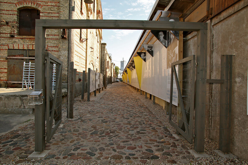
The Riga Ghetto Museum is located in the historic area bordering the former Jewish ghetto in the Latvian capital. Over 70,000 names of Holocaust victims and a photo exhibition, focusing on the anti-Semitic propaganda, the Holocaust in Latvia, the resistance movement and those who provided safe haven, are set on a piece of land, covered by cobblestone taken from the streets of the former ghetto.
This neighbourhood still consists of small wooden houses with wood-carved shutters, cobblestone streets and rusty outdoor sinks in courtyards. Russian merchants and poor Jewish families once lived there; today, the area is often visited by Jewish family members to find where their relatives lived many years ago.
Riga is among the few European cities where former Nazi camp territory has remained unscathed by architectural change.
Cape Kolka
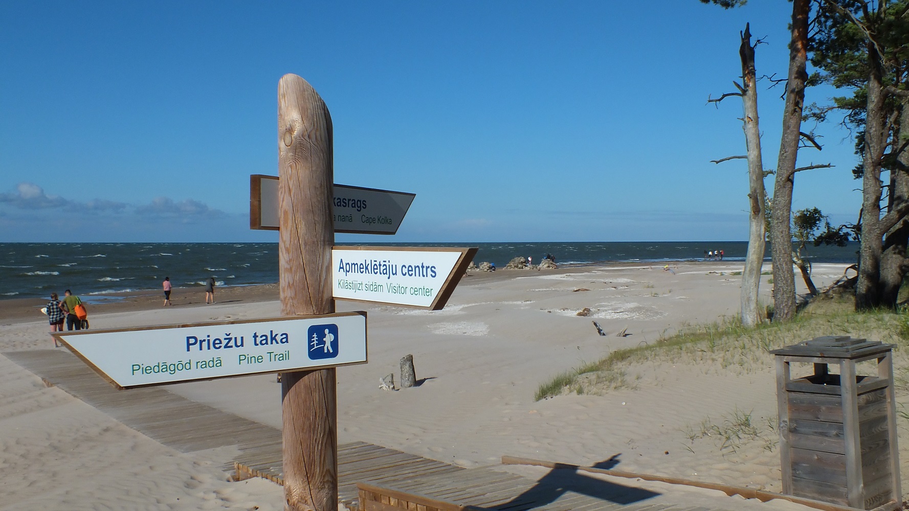
This is the place where the waves from two seas, the open Baltic Sea and the Gulf of Riga, clash. The cape is surrounded by Irbe Strait that serves as the natural border with Estonia (east of the cape is the Estonian island of Ruhnu that lies in the middle of the Gulf). Nearby is the Slītere National Park.
Close by are also the old settlements of Livonians – a Balto-Finnic people indigenous to northern Latvia and southwestern Estonia. They historically spoke Livonian – a language closely related to Estonian and Finnish. Sadly, the last person to have spoken it as a mother tongue died in 2013, making Livonian extinct (as of 2019, there are about 200 people in Latvia and handful in Estonia who had learned it as a second language).
The town of Mazirbe has the Livonian Community House that was built in the 1930s and the village of Kolka has a Livonian Culture Centre.
Lithuania
Neringa
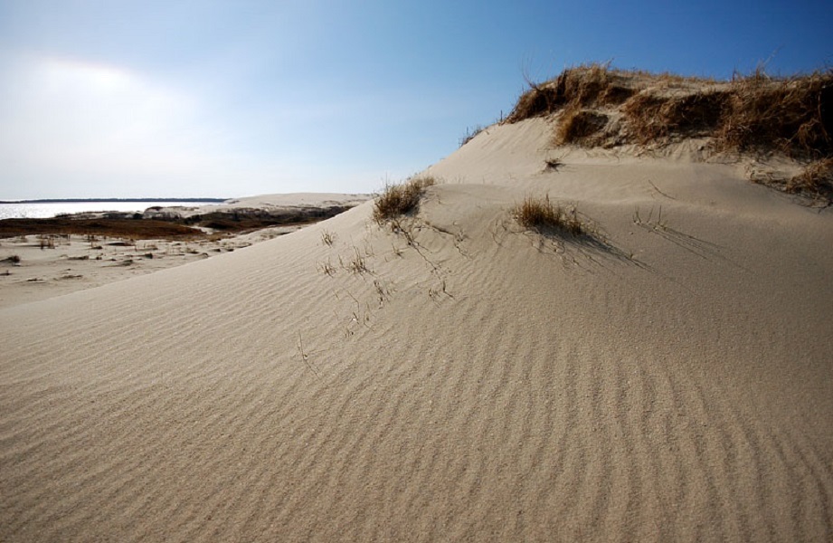
Neringa is a picturesque area in Klaipėda County in the westernmost part of Lithuania, comprising several fishermen’s villages in the Curonian Spit – a 98-kilometre (59-mile) long, thin, curved sand-dune spit that separates the Curonian Lagoon from the Baltic Sea coast. According to a legend, the spit was formed a long time ago by Neringa, a girl giant who poured the sandy peninsula into the Baltic Sea to protect the peaceful bay from the stormy sea and create an embankment for fishermen to live.
The peninsula’s northern portion lies within Lithuania and the southern portion within Kaliningrad Oblast, Russia.
The Curonian Spit is home to the highest moving (drifting) sand dunes in Europe. Their average height is 35 metres (115 feet), but some attain a height of 60 metres (197 feet). The peninsula is also a UNESCO World Heritage Site, shared by both Lithuania and Russia.
The Kirkilai observation tower in the Biržai Regional Park
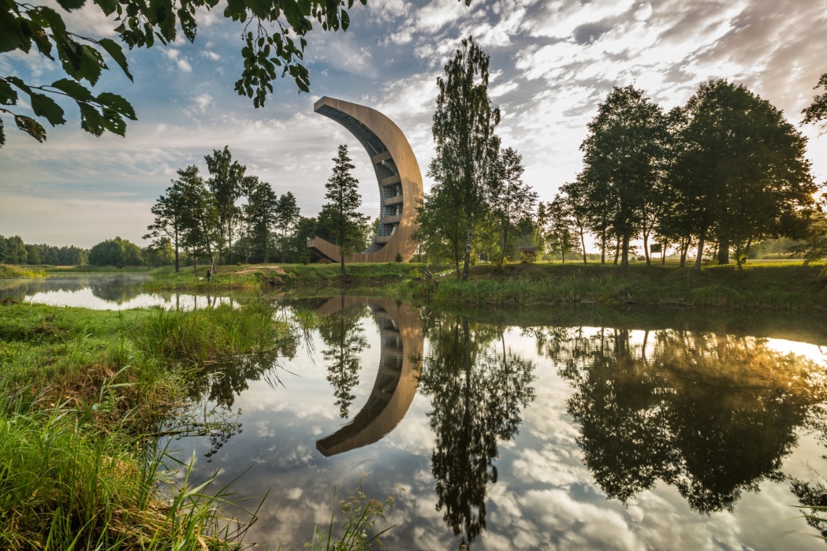
The Biržai Regional Park, notable for its sinkholes, created by the dissolution of the gypsum underlying its soil, was established in 1922 with a purpose of conserving, enhancing and promoting rational use of a unique karst landscape, natural ecosystem and cultural heritage.
The Kirkilai observation tower’s stunning form resembles a canoe or a sinking boat. But more importantly, from a height of 30 metres (98 feet), one can see 30 water-filled sinkholes that formed here due to karstic processes – called the lakes of the Sanctuary of Kirkilai. In summer, under certain conditions, the lakes can be of different colours.
Treetop Walking Path
The Treetop Walking Path in Anykščiai regional park provides an opportunity to take a walk high above the ground, at the level of treetops. The walking path, 300 metres (980 feet) long, rises steadily and then continues long the treetops at an altitude of over 20 metres (66 feet). At the end of the walk, there is a nice view over the Šventoji River Valley.
Hill of Crosses
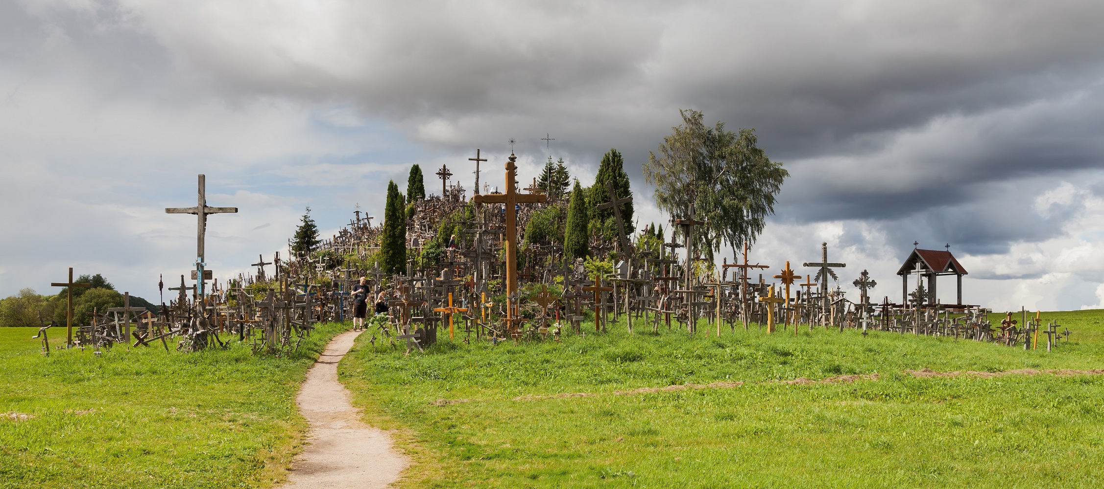
The Hill of Crosses is a site of pilgrimage about 12 kilometres (7.5 miles) north of the city of Šiauliai in northern Lithuania. The precise origin of the practice of leaving crosses on the hill is uncertain, but it is believed that the first crosses were placed there after 1831.
Over the generations, not only crosses and crucifixes, but statues of the Virgin Mary, carvings of Lithuanian patriots and thousands of tiny effigies and rosaries have been brought here by Catholic pilgrims. The exact number of crosses is unknown, but estimates put it at about 55,000 in 1990 and 100,000 in 2006. And over the generations, the place has come to signify the peaceful endurance of the Lithuanian people.
The Hill of Crosses also has a stone inscribed with the words of Pope John Paul II: “Thank you, Lithuanians, for this Hill of Crosses which testifies to the nations of Europe and to the whole world the faith of the people of this land.”
And over the generations, the place has come to signify the peaceful endurance of the Lithuanian people.
Palanga Amber Museum
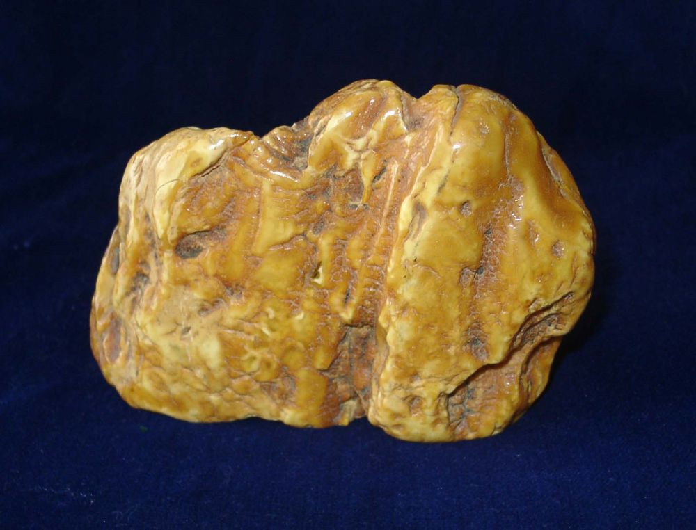
In the “Baltic bubble” at least, Lithuania is renowned for its amber. The Lithuanian mythology, folklore and art have long associations with amber; the legend of Jūratė and Kastytis imagines an undersea palace of amber under the Baltic, which was shattered by Perkūnas, the god of thunder. Its fragments were said to be the source of the amber that still washes up on the beaches nearby.
Amber workshops appeared in Palanga during the 17th century and by the end of the 18th century, the town was the centre of the Russian Empire’s amber industry. In 1897, a Lithuanian nobleman built the Neo-Renaissance-style palace that now houses the Palanga Amber Museum. About 4,500 pieces of amber are exhibited and the museum also holds Europe’s third largest amber specimen, the “Sun Stone”.
And, since we are Estonian World, as a cherry on top, here’s a bonus, the sixth unique spot in Estonia: Ämari military cemetery

The Ämari military cemetery in Lääne-Harju Borough, Harju County, is probably the coolest cemetery (well, as cool as a cemetery can be) any little boy can imagine – and as we all know, men never grow up.
Located near the Ämari Air Base – a major Soviet air base in Estonia during the occupation and now a NATO air base – it’s known as the burial ground for Soviet airmen who were killed in plane crashes. On the graves of these airmen lay the tails of fighter jets – however, it’s not known whether these tails are from the planes they flew or others.
It is not known how many people were buried at the cemetery. The first funeral of a Soviet airman at the Ämari military cemetery took place, reputedly, in 1949. It’s generally deserted, but some graves are taken care of. It lay about 42 minutes south-west of Tallinn, and its coordinates are 59° 15′ 0.13″ N, 24° 14′ 9.22″ E.
Monika Petkeviciute, Toms Ancītis, Dace Strelevica-Osina, Reelika Virunurm, Ingrid Hankewitz, Sten Hankewitz and Silver Tambur contributed to this story.
Cover: The Big and Small Taevaskoda are on the banks of the valley of Ahja River in south-eastern Estonia. Photo by Katrin Laurson (Visit Estonia). *This article was originally published on 4 July 2020 and lightly edited on 1 July 2021.
Merci beaucoup, pour ces ballades baltiques, apaisantes aujourd’hui mais l’Histoire a laissé des traces pour que tous sachent bien, que ces petits pays par la taille, ont eu un passé dramatique (pas si loin , pourtant ) . La paix revenue, ses pays ont mis en valeur tout leur patrimoine, riche de souvenirs et de modernité ! J’ai respiré à plein poumons cette ambiance et n’ai plus qu’un désir : parcourir ces endroits avec curiosité et plaisir !
Je ne vous ai pas dis, mais mon père était Estonien, né à Narva en 1920 , de parents Estonien et Finlandais ( Carélie, précisément ) . Il me tarde de revenir plus longuement et m’imprégner de cette ambiance, j’adore, merci !
Marie